In order to satisfy the basic conditions set down in the Localism Act and the 2012 Neighbourhood Planning Regulations it is important that the Neighbourhood Plan is evidence-based. Robust evidence is needed to support the approach followed and specifically to help develop and justify the selection of plan policies. Evidence can be divided into two main categories:
1. Quantitative data
– based on facts and figures generally available online or published by government organisations including the Office of National Statistics (ONS) and local authority sources. Examples include population census data, information about housing and information about the environment.
2. Qualitative data
– typically is descriptive in nature (and therefore harder to analyse using conventional techniques) but can be very useful as a means of identifying people’s views and understanding the way people or groups feel about things. A good example is the information and opinions provided by individuals responding to the invitation to offer their own comments in the Neighbourhood Plan Questionnaire Survey.
Without evidence the policies in the Neighbourhood Plan may be challenged by objectors making representations based on their own evidence and the Plan may not be effective in influencing the outcome of planning applications – and hence in achieving its objectives. It is good practice therefore to ensure that all of the policies in the Neighbourhood Plan are supported by a brief statement setting out the reason for including the particular policy and the evidence available to justify its selection.
As part of the process of building the Evidence Base much of the information collected is being documented in a series of reports which compile and analyse the information needed to support policy choices. These can be accessed via the Downloads button and currently include the following:
Evidence Base: Socio Economic Profile, Research Report 1, 23 September 2016
Using independently collected data from published sources, this report focuses on the socio-economic characteristics of the resident population including household structure, mobility, employment and housing. The analysis highlights a number of important features of the Neighbourhood Area and evolving trends between the 2001 and 2011 Population Census.
Evidence Base: Questionnaire Survey - Analysis and Overview of Findings, Research Report 2, 9 November 2016
This report describes the main findings of the Questionnaire Survey carried out during May 2016. It discusses the views of the community on the future of the Parish and complements the earlier report on The Socio-Economic Profile of the Neighbourhood Area which relies upon published, but less recent information from government sources. The analysis aims to explain what the community values most about Holme and to understand preferences for any future development. It also draws together the hundreds of comments and suggestions received from individual participants in an effort to identify common themes that can be incorporated into the Neighbourhood Plan, either as Policy or in the form of Action Plans.
Evidence Base: Questionnaire Results Report 1 – All Respondents, 25 August 2016
This report presents the results of the Neighbourhood Plan Questionnaire Survey in the form of graphs based on the total response (206 replies from main, second and mobile homes).
Evidence Base: Questionnaire Results Report 2 – Main Homes, 31 October 2016
Of the total 206 respondents to the Questionnaire Survey, just more than 50% (105) indicated that their main home was in the village. This report presents the results for this group of parishioners.
Evidence Base: Questionnaire Results Report 3 – Second Homes, 31 October 2016
This report presents the results of the Questionnaire Survey for those respondents who indicated that they had a second home in the Parish.
Evidence Base: Questionnaire Results Report 4 – Points of View, 18 December 2016
This report is based on qualitative information collected via the Neighbourhood Plan Questionnaire Survey and summarised using a Word Cloud analysis technique. It presents individual comments and opinions on (i) the importance attached to particular buildings, places and views in the Parish and (ii) community services and facilities and also (iii) general comments, including ideas and suggestions for the Neighbourhood Plan.
Environment Report – designated Areas, Evidence Base Research Report, 19 March 2017
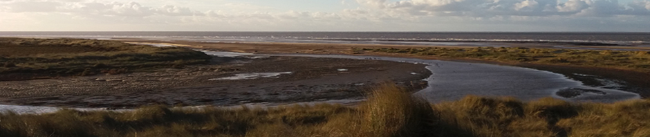
Any plan developed for Holme next the Sea must take into account the very special nature of its natural environment. Holme is within touching distance of internationally significant conservation sites that are heavily protected by both EU and UK national legislation. In addition, it has areas covered by national and local designations (both statutory and non-statutory) which must also be considered in the planning process. Holme is relatively unusual because the form of the settlement is such that its northern extremity is almost surrounded by European Protected Sites and the northern boundary of properties along Westgate and Kirkgate shares boundaries with them.
In order to comply with Regulation 9 of the Environmental Assessment of Plans and Programmes Regulations, (2004) the constraints placed on and opportunities for sustainable development in the Parish must be understood. As one element of this process, this report presents maps of the Parish showing the boundaries of the designated/protected areas and explains the reasoning behind their creation. The NPPF requires that the planning system should contribute to and enhance the natural and local environment and this evidence will thus form basic information for guiding sustainable development policy in the Neighbourhood plan.
Proposed Land Use Zones, Evidence Base Research Report, 10 November 2017
The purpose of this document is to propose a spatial basis (zoning system) for Area-Specific policies in the NDP, justify the structure, explain the broad objectives for each zone and in particular to ensure that it:
- Provides a basis for moving forward that is consistent with the existing SADMP/Core Strategy and, where possible at this point in time, the emerging Local Plan.
- Forms an effective framework for developing NDP policies and clear guidance for implementation by decision-makers.
- Has the support of BCKLWN and
- Can be presented with confidence to the next Parish Consultation.
The underpinning logic of the zones is that different parts of the Parish are appropriate for different types of development and not appropriate for others. To achieve sustainable development it is necessary to get the right type of development in the right place. For example, it may be appropriate to locate new housing within the Settlement Zone but not appropriate within the internationally designated sites.
The Parish Economy: Evidence Base: Research Report - 14 January 2018 (Updated 27.04.18)
A central aim of the Neighbourhood Development Plan is to help foster a prosperous and thriving Parish economy. The main purpose of this report is to create an economic profile for the Parish based on the best information available in an attempt to answer some key questions:
- What is the Parish’s economic structure?
- What are the main sources of jobs and household income?
- What are the main economic drivers?
- What are the costs associated with income generation?
- What are the opportunities for economic development and what are the threats to continued prosperity?
In the light of this profile and on the basis of understanding the Parish’s main economic drivers, the report provides evidence for formulating NDP policies that will help to ensure the Parish’s economic future.
A summary report is also available on the Downloads area of the website.
An Ecosystem Services Perspective: Working Document , January 2018 (updated April 2018, May 2018)
This document is a working paper, originally put together by Natural England’s Landscape and Natural Capital Team for North Norfolk in advance of a site visit to Holme-next-the-Sea. The visit was made at the suggestion of Natural England following earlier discussions with the Neighbourhood Plan Team organised in connection with the NDP consultation process. The purpose of the visit was to view at first hand some of the issues and opportunities facing the Neighbourhood Plan and to provide a better understanding and context for the Ecosystems Services and Natural Capital approach adopted as the basis for Neighbourhood Plan policies.
This paper should be viewed very much as part of the consultation process. It’s main purpose is to inform the approach taken in the Neighbourhood Plan and to provide a direct link into the responsibilities and relevant work carried out by Natural England, notably that on the National Character Areas. At the same time it draws on feedback from the community, highlighting in particular their views and concerns about their local environment. The paper has generated a large number of ideas – some of which have contributed to the NDP, some of which will need to await the first review of the Neighbourhood Plan or the outcome of further research / monitoring – and some of which might be taken forward as actions to be pursued by the Parish Council. Prior to the site visit, the ecosystems and natural capital approach was little more than an idea – the “perspective” advanced in this paper provided the confidence to take the idea further and together with the relevant National Character Area Profiles provided a basis for developing key NDP policy.
Heritage Evidence Base: Research Report - 21 May 2018 (updated 21 July, 2018, 08 August 2018)
The main objective of this report is to review the history and development of Holme in order to provide a sound understanding of its heritage as the basis for developing NDP policy and providing a sound basis for protecting and promoting the Parish’s heritage. There is evidence of settlement in Holme from over 4000 years ago and the parish has a rich and interesting heritage record. The historic landscape, archaeology and buildings make a vital contribution to both quality of life and sustainable tourism in the Parish. It seems very likely that there is much more evidence still to be found and scope for further exploitation of its value as a tourist resource.
A second objective therefore, is to bring together within a single document an inventory of the Parish’s known heritage assets and to make these readily available as a management resource to help stakeholders (including developers, planners and the Parish Council)to make informed decisions on Heritage when proposing and assessing projects both large and small and to enable sustainable exploitation of heritage assets as one important element of the Parish Economy.
Water Quality, Evidence Base Research Report , 20 March 2017 (Updated 20/12/2017; 14/2/2018; 03/06/2018; 31/01/2019; 16/04/2019) – supercedes Interim Report
In response to the NDP Questionnaire survey and to reports of pollution and declining observations of wildlife in The Hun, the NDP team decided it was necessary to follow up these concerns to provide a sound basis for the policies being created for the NDP. This decision coincided with an approach to the Parish Council by the Norfolk Coast Partnership who, working with the Norfolk Rivers Trust, have been successful in establishing improvement programmes for other chalk streams in Norfolk and wanted to explore likely levels of support for a programme of improvements to the Hun.
In spring 2017 sightings of a persistent algal bloom on Broadwater Lagoon gave rise to further concerns about pollution of Parish water bodies. Following preliminary analysis of water quality in both the River and the lagoon it was decided that it would be important to carry out detailed investigations to examine water quality and its likely impact on wildlife/environmental health.
In order to establish priorities for the project and to begin addressing the pollution issues, the NCP, NRT and the Parish Council (via the NDP Team) agreed to work together on a programme of water quality monitoring spanning the period from May 2017 through to December / January 2018. NRT agreed to fund a demonstration / training exercise followed by a further 6 months of structured water sampling based on four sites in the Hun Catchment and one on Broadwater Lagoon. All samples were analysed by the Environment Agency at their National Laboratory.
This report presents the findings of this work.
Report on environment, landscape & biodiversity, Evidence Base Research Report , 20 March 2017 (Updated 20/12/2017; 14/2/2018; 03/06/2018; 31/01/2019, 09/02/19)
The NDP consultations have revealed strongly held local concerns about environmental degradation and a desire for positive environmental management aimed at halting its decline. Given this background and the very sensitive nature of Holme’s natural and historic environment, it is important that the NDP has a strong, positive environmental impact. It must also meet all of the regulatory requirements associated with the various landscape designations in the Parish.
For the NDP to satisfy these requirements, four things are required:
- Identification of the important features of Holme’s natural environment and assembly of baseline information defining their current status.
- An understanding of current influences on these features and an indication of whether their status will improve, remain stable or deteriorate in the absence of an NDP.
- Identification of the main environmental problems and opportunities facing the Parish.
- Clear environmental objectives based on an understanding of this information that can inform and underpin NDP policies leading to positive improvements.
- The main purpose of the report is to provide this information.